Could the trip be nixed even before it begins? A low pressure system is surging out of the south drawing up warm moist air. And Chicago is right where that air and cold air from where I am going (the Arctic) are meeting! What’s worse is the low is making the winds turn North Easterly on Saturday. This means the wind will come of a nice body of water around 36F turning on a lake snow machine! Usually I would be egging this bad boy on, but I have a flight to Denver connecting to Anchorage leaving at 8:50am.. Will I even get to go North after all?

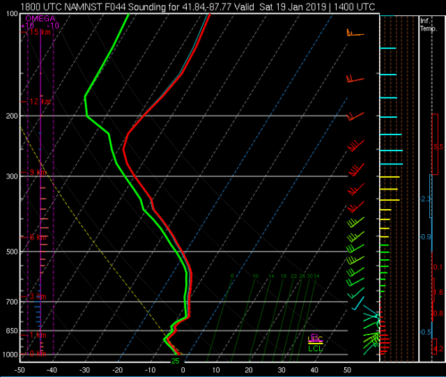
Current North American Model forecasts a total of just on 10 inches between snowfall start and my flight’s departure time. I am hoping that I am on a 757-300 will mean: Its a bigger plane, less prone to weather delays AND a harder decision to cancel as a fill 757-300 is a lot harder to re-accommodate than, say, a small regional jet. (Probably not how this works, but its my blog and I am sticking to it). To make matters worse (or better for snow lovers who don’t need to catch a flight) there is an isothermal (same temperature) layer around 1.5km high at around -10ºc. This is the ideal temperature for transferring water out of the atmosphere (water vapor) into snowflakes (called a dendritic growth layer). This is weather geek speak for ITS GUNNA SNOW HARD. So now I place my hopes on a missed forecast, which is entirely possible as this all hinges on the model nailing the trajectory of the low pressure system. Hardly a given at this time of year. Small errors in low location changes the surface winds considerably and could nix this whole system. Here is hoping! (sorry snow lovers). Graphics come from the College of DuPage’s Nexlab. Kudos folks!