

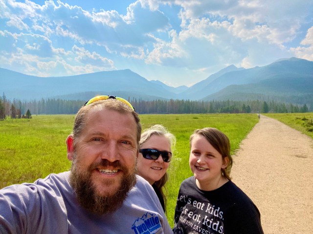
We decided to spend two nights in Fort Collins to give our Child a self-guided tour of the CSU campus. This also mean pack up day at the cabin could also include taking the longer route from above Twin Lakes to our hotel in Loveland. The quickest way to Loveland was the way we came from Boulder, along the major artery that is I70. But how could a trip to Colorado be complete without visiting a National Park? So We discussed our plans Tuesday night and decided to take the long way around. Going via Granby and up via the Trail Ridge Parkway in Rocky Mountain National Park (RMNP). I did not know it at the time but this drive would take us through the absolute gem in the National Park system (and yes I capitalized that on purpose), the trail ridge parkway, or US highway 34 https://en.wikipedia.org/wiki/U.S._Route_34.

Before I talk about the amazing part of the trip let me first say the trip from Silverthorne to Granby was really no more than a race across rolling plains like Iowa and Nebraska. Albeit with some amazing geology but the landscape had been raped and pillaged. Not an issue unique to America form my world traveler point of view.
Anyhoo, back to Highway 34. This unassuming tarmac starts as a turnoff near a gas station in a dry valley just before Granby and climbs to reveal a massive reservoir replete with signs thanking fire services (stop burning carbon if you want to thank them, did I say that???). It is clear the residents had much to thank folks, professional and volunteer for. Scorched earth backing up to verdant green surrounding property. Something very Australian about this scene.

RMNP started with burned out fee stations and trees burnt and bent by fire forced winds. The underbrush was not spared, and it was clear parts of the park were in for a long recovery.


Turn outs and picnic stations taped off like a crime scene (like? Perhaps as a crime scene). Grassy glades were spared and provided a lush contrast against the black. Made all the more inviting for the death and destruction around. Fortunately, dear reader, things did change. First I will talk about something more pedestrian, the speed limit. In RMNP the speed limit ranged from 35 to 45mph (56 to 72 km per hour for my antipodean (and the rest of the planet) friends). With the overwhelming majority being at the former lower limit. This lower limit protects the wildlife, allows stopping for roadside safari and generally creates an atmosphere that encourages savoring rather that gluttony. As you may perceive I wholeheartedly relished this state-imposed slowdown.


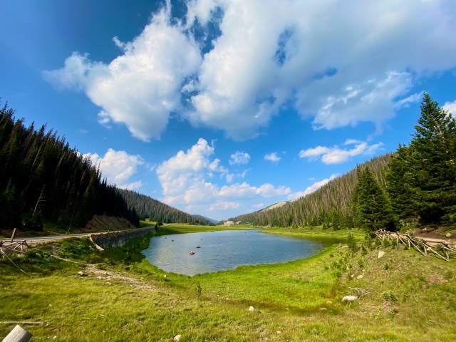

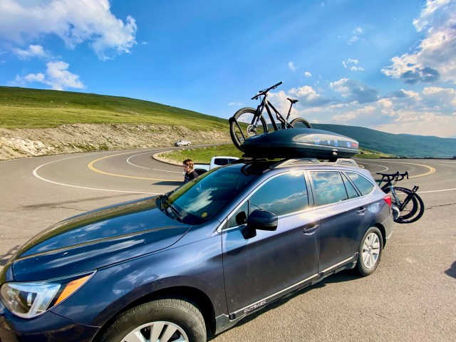
Just after we finished though the sad burnt forest, we did a sharp right had turn with a 20mph warning sign with a number “1” denoting the first of many switchbacks. We climbed, stopping occasionally for wildlife, the views got better and better with glacier scarred valleys and peaks. In the end we had company of fellow travelers including a wonderful group of bikes who allowed locals and immigrants to pose on their bikes for photos, completely heartwarming. We hit the continental divide at Milner pass where we were treated to an alpine tarn full of anglers on floats. We thought, at 10, 759 feet (3279 meters, a full 1051 meters or 3448 feet than the highest point in Australia’s mainland) we were done with climbing… Oh no. The road pushed on to the tree line and above. What followed was the US Government’s attempt to introduce the public to the awe and majesty of nature. Successful I do hope and if not those whose hearts are not touched by this unique landscape are truly lost. Majestic peaks, resilient tundra, ice fields, crepuscular rays.. We hit 12,209 feet. Higher than the 12,095 of the Independence pass. Out highpoint for the journey. I could go in. It’s all there! A John Muir sampler box. I could go on but it is nearly 9pm the day after and I have 500 miles plus to put in tomorrow so I will let the numerous pictures in this post to the talking for the miraculous journey we had yesterday. More to come!


