Second up day of my time in Houston as a mission scientist. Early storms were not as strong but this is a good thing as it really allowed the energy and moisture the big clouds we are studying to grow. After two days traveling all around Houston today was a day to stay closer to my home base in Kemah. An interesting little tourist area with a boardwalk and funpark I chose Kemah because it is very walkable. In an area like Kemah I can get out and roam and observe the clouds we are so interested in.
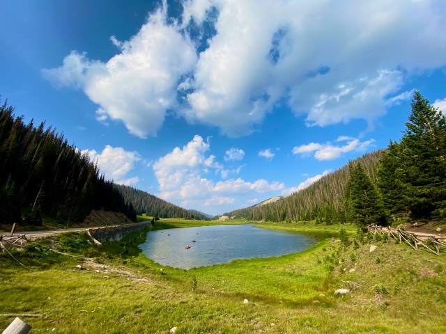
Panorama of morning showers from the Kemah boardwalk.
This morning I walked out to the boardwalk as some early storms were forming and moving into the area. The bay affords a great view back. The forecast from Bobby and team yesterday was spot on and storms formed on a later forming Gulf breeze (a type of wind generated by the differences in temperature between the waters in the Gulf and the land). Too successful in fact as one of the storm systems hit Liz’s drone site! But exciting to see how those big clouds impact profiles of temperatures.
When it is hot iced is nice
A hotel TV makes a great tool for zoom calls!
Very lucky to have a nice coffee shop in Kemah. After a hot walk I eschewed my usual choice of a latte and got an iced coffee. After seeing to some tasks back in Chicago (being a department head means it is hard to leave my duties back in the Midwest..) I hopped on the forecast and operations call for ARM TRACER. We are very lucky to have a range of very talented forecasters from professors to VERY capable students and even NWS staff. After two very lucky days things are drying out in the TRACER region (~100km around La Porte) although some storms are possible to our north. Good news is storms are firing away today so we did not have to abort enhanced operations at the ARM site and we have collected another very nice case study to understand the impact of tiny particles on big clouds. However, as mission scientist I called a “down” day tomorrow.
Feeling lucky indeed!
Of course normal ARM operations still means unprecedented frequency and fidelity of observations Right when the forecast call ended the whole Kemah area experienced a power outage. A quick pack and I went mobile again finding a local pub with blazing fast internet. There I took another ARM call, this one on the use of AI on camera systems. It was actually (lucky!) I went mobile as on the way back from League City I was treated to a show of a developing big cloud that go so big it hit the top of the atmosphere and formed what we call an anvil for that classical thunderstorm shape. I was so happy that we were launching soundings and our friends from TAMU, OU, TTU, Stonybrook and other collaborators were out there with mobile radars and other platforms measuring that storm right over Houston! Lucky indeed.
Yesterday on the forecast and operations call as the mission scientist I called an “up day”. A day where the ARM Facility will place its observatory in a state of increased vigilance. More soundings (weather stations on balloons to understand how temperature, water and winds vary with height in our atmosphere) and our radar our in Pearland, Texas will execute a special algorithm to follow storm systems. This was based on a forecast produced by the TRACER forecast team who are doing an outstanding job!
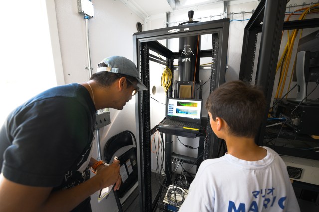
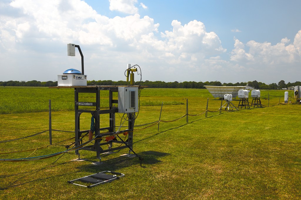
Oli and Marcus read data from ARM’s Micro Pulse LIDAR.
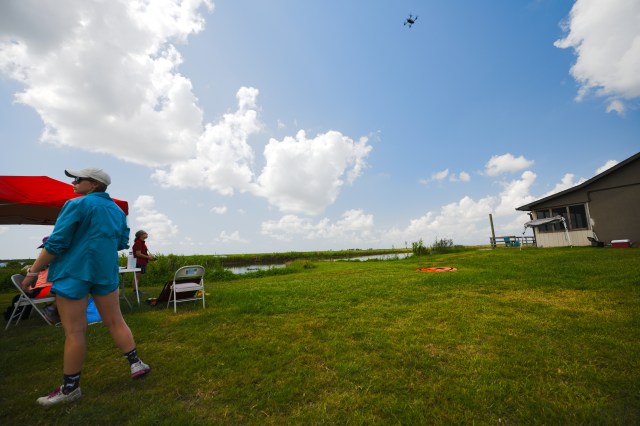
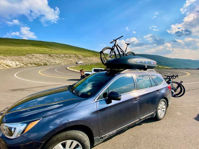
I will not bury the lede, the forecast panned out! An amazing day of storms in the Houston region well captured by DOE and NSF radar systems! Now, for the Up In The Air bit. I have several missions here in Houston. One is to understand the wider TRACER field program. Today I connected with my long time friend Marcus Van Lier-Walqui. We both want to understand the Unmanned Aerial Vehicles (UAVs) part of the ASR funded component of the TRACER campaign. We headed south west of the ARM site featured yesterday to sites run by Colorado University in Boulder and the Cooperative Institute for Severe and High-Impact Weather Research and Operations (CIWRO) at Oklahoma University.
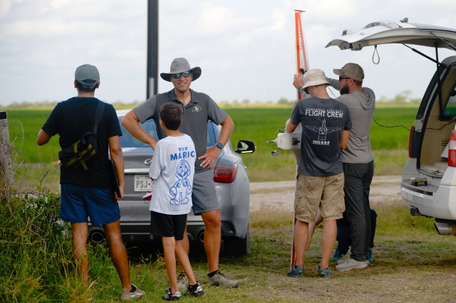
Justin heads into the fields of Texas to retrieve a UAV.
We started the day out with Gijs, who was here with Justin, Jonathan and Radiance. They were flying a very impressive UAV fixed wing platform over pasture here in Texas. The launch system was amazing and while completely safe was a little intimidating. Managed risk! this is what the best people do. A bungee cord rapidly accelerates the UAV to get lift so the rotor can take over thrust once clear of the launch platform (a table… your tax dollars being spent very wisely!). The platform then measures the winds (heat and water) that goes into those big clouds we are studying. The heat and water are vital to understand because we want to see clouds that have the same heat and water but different mixtures of tiny particles. Only then can we understand how those tiny particles change those big clouds.
Gijs mentoring and inspiring as always.
Our next stop was to visit Liz, Michelle and Francesca flying a completely different UAV, a quadcopter. This amazing platform, more akin to the platforms starting to dominate the consumer market, does a profile of the same heat and water for those big clouds from the ground to 2,000 feet every 15 minutes! To put that in perspective I am crazy excited about ARM launching those balloons every hour. Both platforms are posterchilder for American ingenuity, home built over a decade with the kinks worked out by trial and error. I feel so honored to be an intruder on work that has taken blood sweat and tears over many years to make work.
Michelle and Liz capturing vital data with the CIWRO Quad Copter.
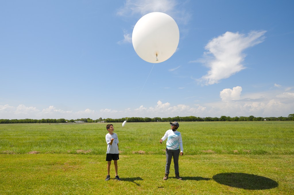
Our final stop was back at the ARM Mobile Facility. Since we had requested enhanced soundings we wanted to check in. Of course the team had it all in hand and we even got to see the Colorado State University radar being installed. Even better, as we arrived the amazing staff at the AMF were launching one of our special sondes! Marcus’ son Olie was with us and Gabby offered Olie the chance to launch the Sonde! So, TRACER scientists, your 20:30 UTC sonde and the science from it is courtesy of Oli Van Lier-Walqui!
Young and the experience. Oli launches a sounding and Francesc is building a radar.
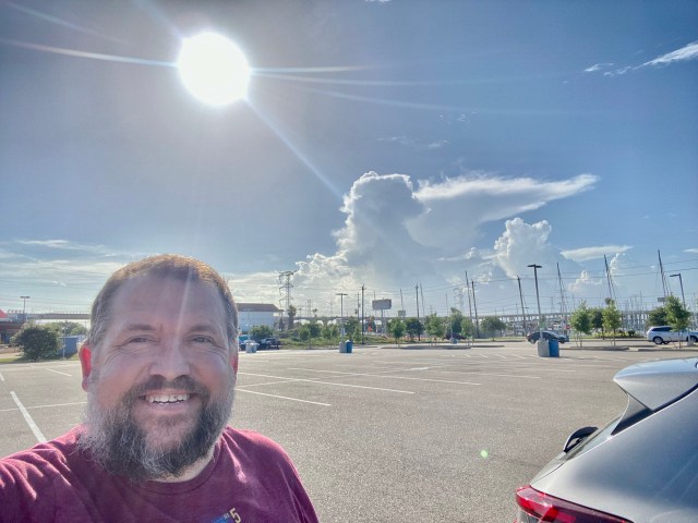
Hitting the ground running, not literally thank goodness as it was hot and humid today in La Porte Texas. Landing last night I was greeted by very nice decaying storms to the east which were very photogenic from where I am staying in Kemah, a touristy suburb on Galveston / Trinity bay.
Storms seen from Kemah, Tx.
Today, my first full day in Houston as a mission scientist was all about spinning up on the weather situation and becoming operationally aware. It was also about getting boots on the ground at the deployment I am a co-investigator on, led by my friend and colleague, Mike Jensen from Brookhaven lab. As discussed in previous posts, this is the TRacking Aerosol Convection interactions ExpeRiment (TRACER). ARM does an amazing job of deploying world class instruments anywhere. This is their first deployment to Texas and, by far, their most urban.
Surrounded by chemical plans, shipping facilities and oil refineries (sources of those little particles that so impact the big clouds of our climate) ARM deploys its usual and very successful playbook. Get good people, build local connections, bring the community along.
Come on clouds! Get big!
For me, today was about: Lead as a mission scientist, understand the deployment and the clouds we are studying and capture the people and unique deployment in pictures and videos. The folks at the AMF (ARM Mobile Facility) greeted me with amazing warmth. Seeing I enjoyed being outside in the heat, safer during this time of COVID, they graciously set up a shelter for me. This also allowed me to use the amazing instruments, including the Scanning Cloud ARM Radar (SACR) as a background for the unavoidable (though I tried) for zoom calls during the day. Plus, of course, the all important forecast and operations call for TRACER.
Mark launching a balloon with a weather station on it to understand the air that fuels those big clouds.
And this pampered office working scientist was even helpful! Helping load a gas analyzer used to study the chemistry of those tiny particles) back into an instrument rack. So, take homes and lessons learned from today? This area of Houston has a heat born of the Gulf of Mexico. Any breeze is most most welcome when temperatures are in the high 90’s and dewpoints (a measure of moisture in the air, when dewpoint equals temperature humidity is at 100%) in the mid 70’s, the AMF is something globally unique, world class that the US Department of Energy can deploy a state of the art earth science observatory anywhere and then tear it down and deploy it anywhere else. No one else does this and I am proud to be a part of it.
The most advanced instruments on the planet, deployed anywhere on it.
So, today, Thanks to Bobby’s leadership, we decided tomorrow looks as good as it is going to get for the whole week for clouds that get big enough to rain which are our science target (the big clouds that are so affected by those little particles). Tomorrow the facility will enter special operations. The weather radar (like you see on your National Weather Service webpage, or by your favourite meteorologist like Tom Skilling in Chicago) will use special software to track storms and the ARM technicians like David, Matt and Mark will launch soundings (balloons with instruments) at an unprecedented rate. All in the hope of catching those tiny particles making those big clouds bigger (or smaller? Let’s see!).
Greetings from O’Hare international Airport. Just dropped my bag off and I am now relaxing in the United Club (yep, I spring, personally, for access as I am an anxious traveler). Flying down to Houston, Texas for a 7 day tour as Mission Scientist for ARM’s TRACER field campaign. It is super fitting I fly to Houston on June 19th as the Juneteenth holiday marks the day that the emancipation proclamation finally made it to Galveston Texas (just outside of Houston).
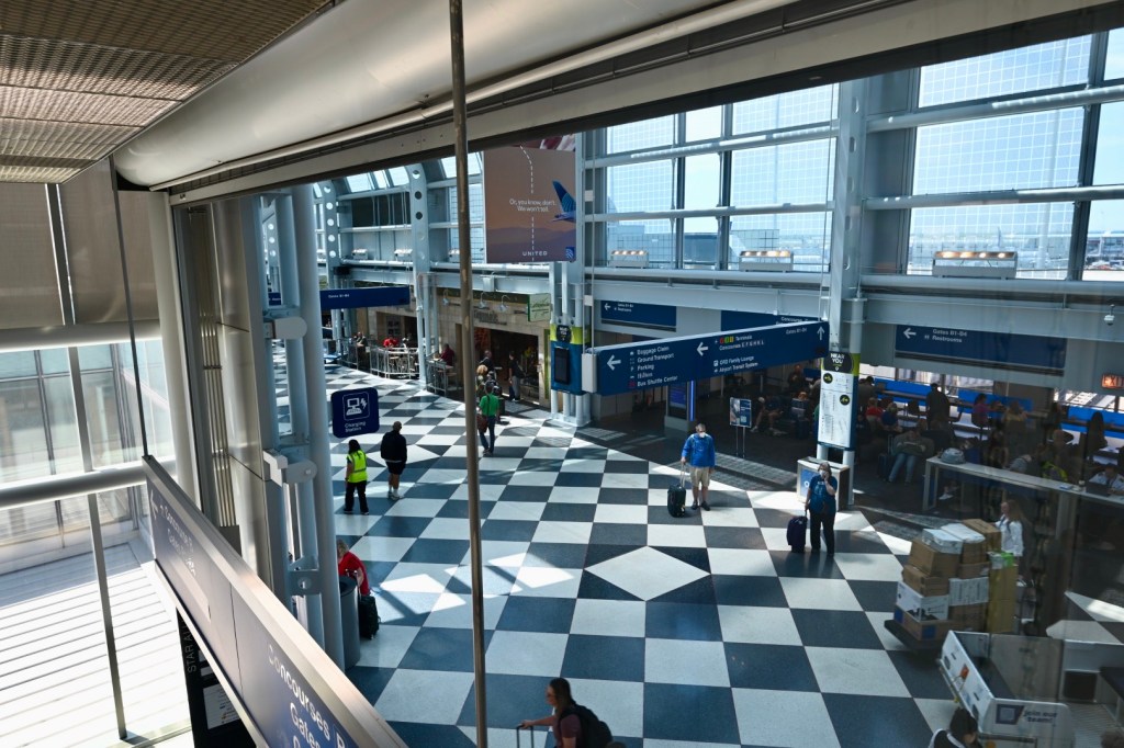
Scenes from O’Hare on Juneteenth 2022
The ARM Facility of the United States Department of Energy is in Houston to study clouds. Specifically clouds that grow big enough to make rain and even become thunderstorms. The fundamental science we are seeking to address is “Are clouds that form when there are more tiny (less than 10 millionth’s of a meter in diameter) particles different to clouds that form when there are less of these particles?” We call these particles Aerosols. They are so small that the force of gravity is small compared to winds and other forces so the essentially float in the air.
Me, kicking off TRACER forecasting.
We are going to Houston specifically because, according to a paper by Ann Fridlind (and myself and colleagues) Houston is usually a cloud factory this time of year. And some clouds hit air with more of these aerosols and some hit air with less. So we can use our state of the art instruments to see if the drops, snowflakes and winds in these clouds change. This is super important as we have lines of computer code in our weather and climate models that contains our current knowledge of the physics of how clouds interact with these aerosols. And we know we need to know more so we can better predict the weather and climate. And, for the Department of Energy, predicting what the impact of our energy choices have on climate is part of the mission. In addition DOE and partners use weather models to predict wind, solar and hydroelectric power. And, yes those tiny little particles have an outsized impact!
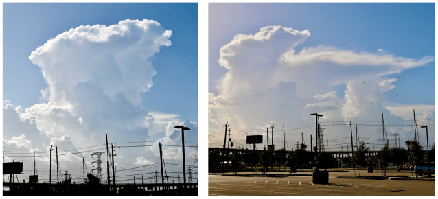
Tracking storms in Houston using open source software. The figure on the left shows the storm factory in Houston turning on in June!
Five (or so) years ago I found out a group was interested in studying thunderstorms and aerosols in Houston. I had been involved in a similar study in Queensland, Australia, so we (myself and my colleague, Robert Jackson) started collaborating and became Co-Investigators on TRACER. Now I am a mission scientist and one of the leads of the forecasting effort! Now my flight is about of board so I have to wrap up! Excited to get to Houston and see those clouds we are studying!
Good morning readers. I have been quiet for some time. This Blog has been very good to me; it has connected me to the media, it has been a wonderful tool for science outreach and it also has made some wonderful lasting records of my adventures! Well it is time to resurrect this blog! Why? for the first time in 11 years I am going into the field for a field campaign! I am a co-investigator on the deployment of the ARM User Facility’s Mobile Facility (aka AMF) for a deployment called the TRacking Aerosol Convection interactions ExpeRiment or TRACER! This quote from the ARM article featuring Brookhaven’s Mike Jensen says it best: “Ultrafine liquid and solid atmospheric aerosol particles are needed to form cloud droplets. In Houston, aerosols come from a variety of sources, including factories, car exhaust, rural soils, and sea spray.”
Data from one of my favorite instruments. The Argonne mentored (by Paytsar Muradyan) Micro Pulse LIDAR. Which can detect those tiny particles we are so interested in!
We are in TRACER to study these interactions. I have a number of roles in the campaign. With Mike, TTU’s Eric Bruning and NASA’s Alex Kotsakis I lead the forecasting efforts. I am also one of the rotating Mission Scientists who make operational decisions regarding the facility’s operation. Sunday I will be flying to Houston for a seven day tour of duty. In addition to being Mission Scientist for that time I will be fully immersed (operationally aware to use an old Bureau of Meteorology (Australia) forecasting term) in the weather of Houston. I also want to draw attention to the amazing instruments ARM deploys in my new role as ARM’s Workforce Development Coordinator (WDC).
Stay tuned as I head south to get my head in the clouds. More DOE Climate Science and ARM geekering coming soon!
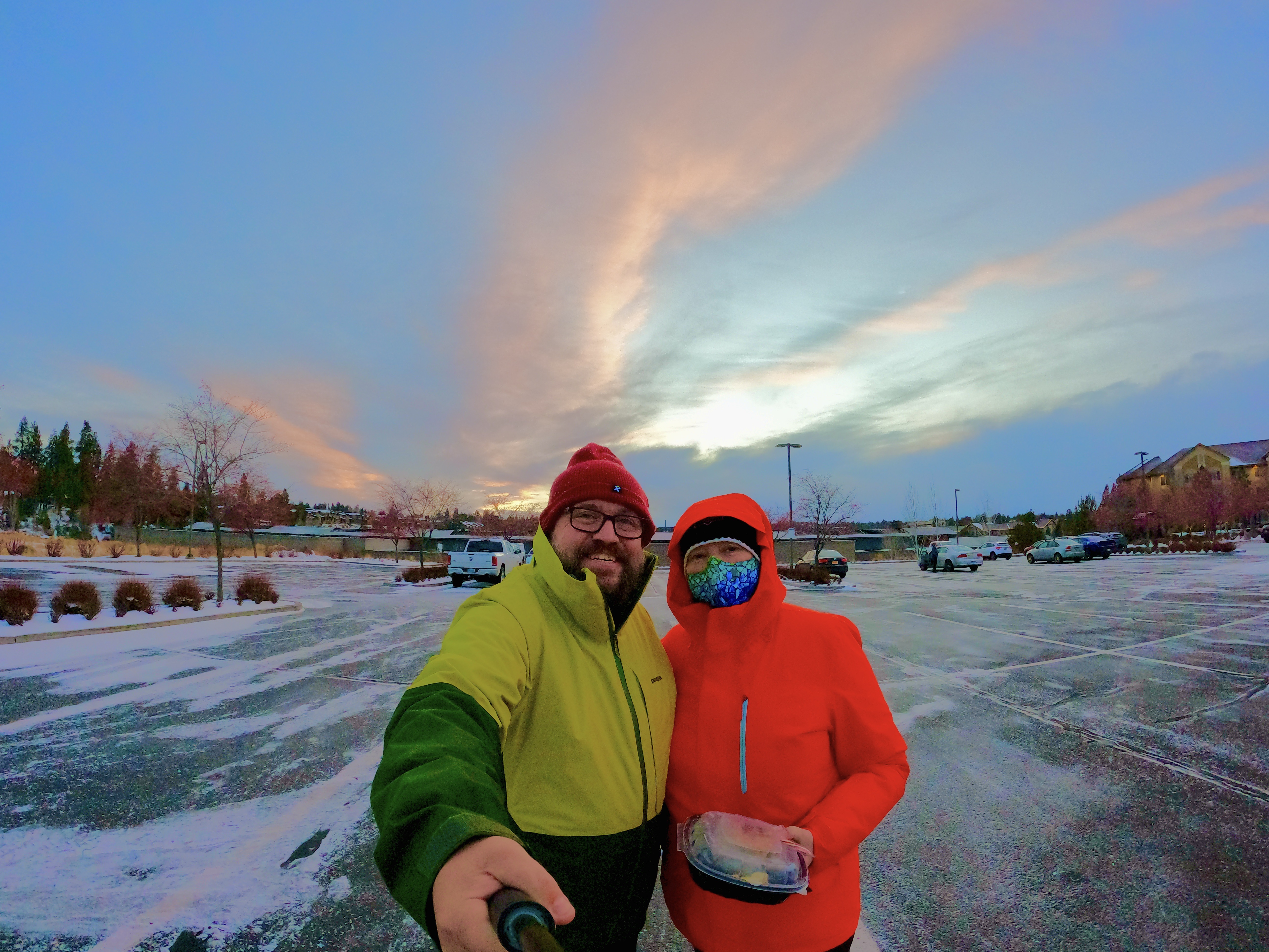
So since many folks who read this blog find it through social media it will come as no surprise that we randomly decided to head to Bend, Oregon, for the Christmas break this year. We wanted to go somewhere we we could ski if the conditions were right but the trip did not have to be completely about skiing. Of course we looked to one of our favourite states first: Colorado. Early research showed us Colorado during winter peak was VERY expensive. So we cast a wider net. I first thought of Bend because I had been interviewed by a journalist who lived in Bend and during idle chit chat that surround the interview process that this guy was a digital nomad and chose Bend for its lifestyle. I also have a collaborator at the University of Oregon whom I queried. He mentioned his Son went to UO Cascades in Bend and, as is common in the USA got a tuition rider BUT my friend said it was probably more expensive that out of state due to frequent trips to the local ski hill, Mount Bachelor.
Time of booking versus time of writing. My height in snow later. Webcam images courtesy of Mt Bachelor.
Well that perked my interest and we found a nicely priced room at the newly built Residence Inn in town. Come December 1st and I was resigned to this being a hiking, biking and relaxing trip as there was anomalously little snow on the ground at Mt Bachelor. Well the snow dance worked and a series of atmospheric rivers dumped over 100 inches of snow (254cm) in 20 days. Yes, 10cm a day on average (for you metrically inclined). Some clicks and a significant amount of River’s college fund spent (kidding) and lift tickets were bought. Come the day to fly from Chicago I was worried Omicron and associated snarling of the aviation industry would scuttle our plans.
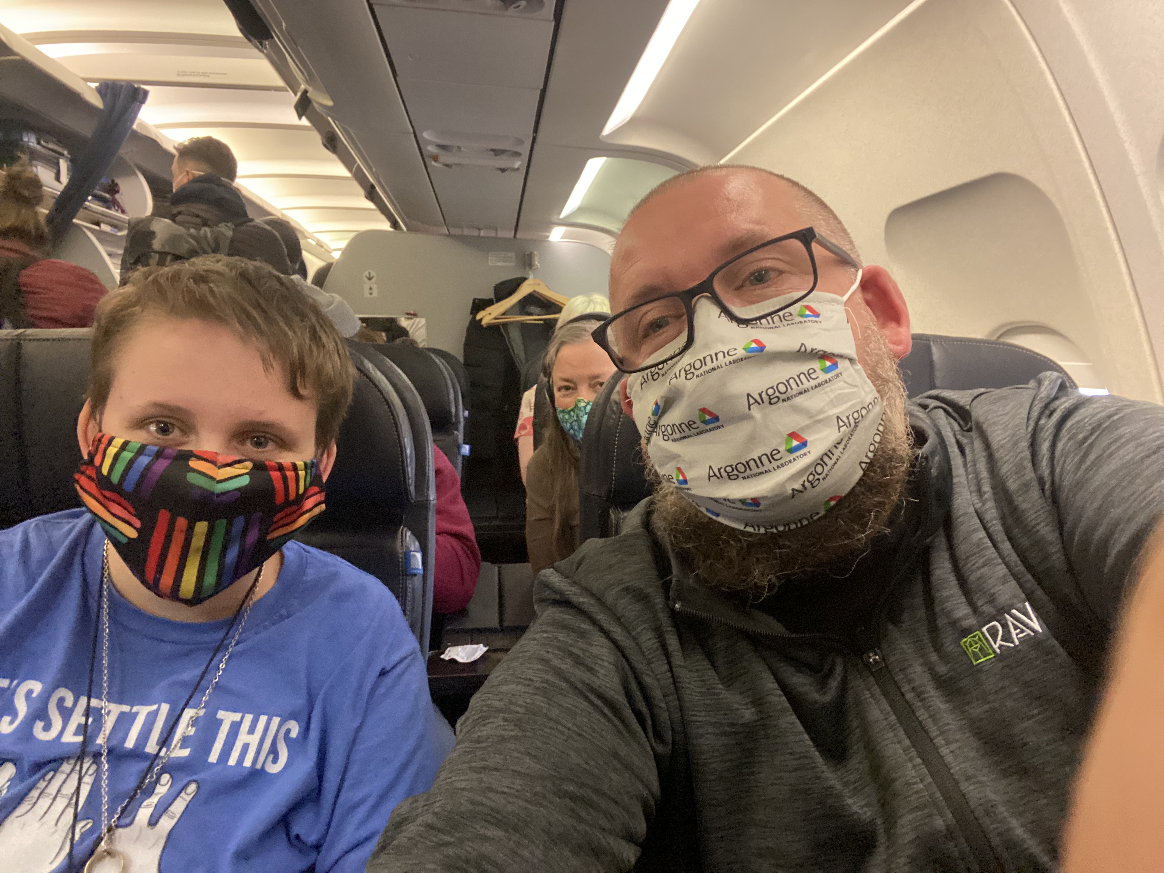
United flight to PDXCrooked River gorgeOn the road again. Flying from ORD to PDX and stopping at Crooked River gorge.
So, now let me address the variant in the room. Yes, we are flying and participating in activities that require congregant settings during a pandemic and amid a lot of uncertainty around Omicron. We discussed it as a family and came to the conclusion we had done everything right (vaxxed boosted, careful, masking etc) and we NEEDED this vacation. High risk, high benefit. After 2 hours of delays (well communicated and handled by United) and we were off. We had booked a night in Salem, OR, planning on passing through a lower pass in the Cascades. A helpful Facebook group helped us find a much longer but safer route (heavy snow still and an unfamiliar rental car) via the Dalles and through the desert west of Oregon. Our Christmas day drive was scenic, relaxing and fun.
Anthony’s at XmasDeschutes River at BendCoffee at PaletteSnowy walk towards the Box FactoryBend sunsetCoffee, beer, food and snow. Yeah, its nice.
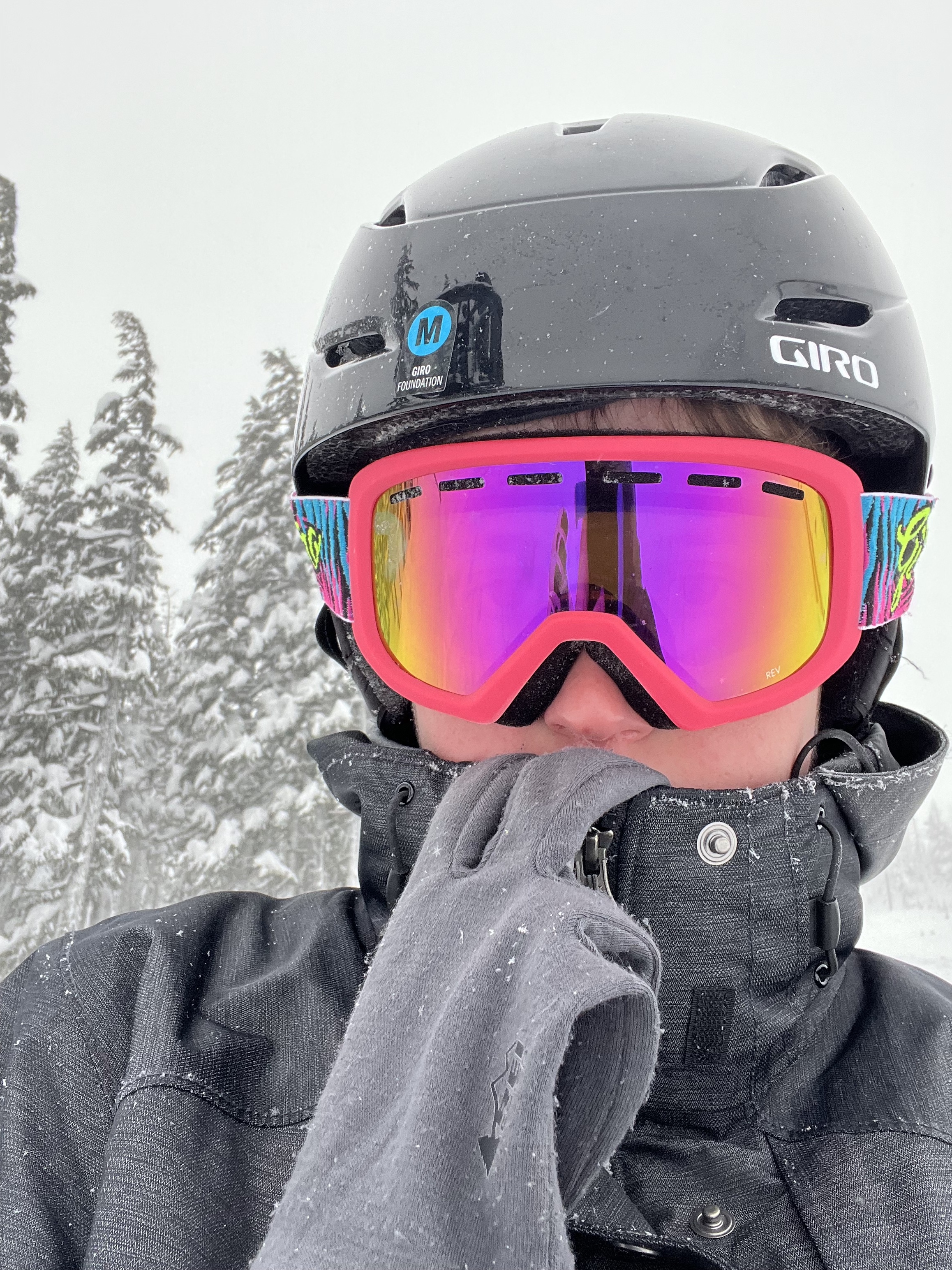
Full of interesting towns, rivers and a huge gorge. Our first full day in bend (Boxing day) was a relaxed event with ~2 inches of dry pretty snow in town (and over a foot on the mountain) of enjoying craft beer and ensuring we had all we needed for our first day of skiing! The 27th (2nd full day in Bend) saw us heading into the Deschutes national forest to the mountain for our first day skiing since 2019 during “The Before”. It was a powder day! River was introduced to powder for the first time and I think they liked it. Downside: COLD. Wind Chills of -30 (at those temperatures Celsius ~ Fahrenheit). Gear worked well but there were a few failure points. After one journey above the treeline we stayed low. River did a lesson and came out linking turns well. We skied from open to 10 mins before close. A great day! Writing this on the 3rd full day in Bend (now a rest day before skiing again tomorrow) I can say I like Bend! Funky geology (volcanoes!) super friendly people and a real outdoorsy vibe. Yeah, I could live here 🙂
Louise putting in the turnsStay frostyRiver looking coolSnowglobeHappy, albeit cold, faces!
We are hiring! Adam, Nicki and Myself are looking to hire two new folks to fill a variety of roles. And I imagine most people who are looking at the job postings are “So what kind of jobs are these?”. I’ll be blunt, America (the USA) has a terrible hang up about describing what a job is and what it pays. We post a job saying “RD2” with no indication as to the renumeration etc… And yes, Americans are very funny about money. So I can’t post salaries or even discuss them here but I am happy to discuss.
Argonne, a lab in a forest!
So, what is a career at Argonne like? First, Argonne is a Federally Funded Research and Development Center or FFRDC. For those of you in the atmospheric sciences NCAR is a FFRDC. Unlike NCAR, Argonne’s prime contract is to the US Department of Energy (NCAR’s is to the National Science Foundation). So as an Argonne employee you are an employee of UChicago-Argonne LLC. This has a slew of advantages and disadvantages compared to being a Fed. Biggest advantage is we can hire foreign nationals a disadvantage is we don’t have the same retirement benefits and security that federal service offers. But we do have a very generous benefits package.
Argonne has a dual classification system. You have a classification for your “working role” and “leadership role”. For example as an Atmospheric Scientist and Department Head I am RD4 + LD2. On the 4th rung of the Research and Development track and 2nd rung in terms of leadership. Most employees are effectively LD-Zero. Within the work role there are a variety of different classifications but the two we are hiring are “Professional Technical” or PR and “Research and Development” or RD. Most of the time, and this is one of those times we onboard at RD/PT level 2.
For the RD role RD2 is somewhat equivalent to hiring at the Assistant Professor level. The lab has a requirement that those who are hired at RD2 get promoted to RD3 in five years. There are two reasons I say “Somewhat”: The process is far less onerous than gaining tenure. And there is no such thing as tenure at Argonne. For example my RD3 promotion case was built around Py-ART. I published one very nice first author paper in 5 years, one two author paper I was second author on and a large number of nth author papers.
The other position is at the PT2 level, although we may hire two RD2s if we get a candidate who is suitable. The main difference between PT and RD is the lack of the aforementioned promotion requirement and the PT path, while highly valued by the lab is in support of R&D.
The other question I get asked is “What is the funding situation like? Will I need to find my own funding?”. To a degree this depends on how you are being hired. Say, for example you are what we call a “Strategic hire”. Here you would be given a year or two of funding to find your legs and build your own program. These are not strategic hires we (Adam and Myself) have more work than people to do it. My philosophy is a RD2 should be focus on building their reputation and science in service of the DOE mission (science for the nation!) and around the time we are looking at RD2->3 be actively involved, with guidance from a mentor, in program development. It is very rare for PT classified staff to be involved in proposal writing.
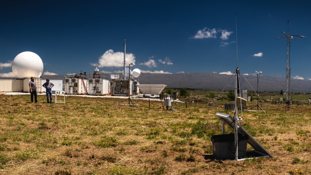
ARM’s deployable C-Band radar in Argentina. You will be working with data from this amazing radar!
When I started at Argonne I was funded only by the ARM program. Over my 11 years here I have diversified the funding I am supported by (and my team). This both opens opportunities and comes with headaches. A successful scientist or professional at a national lab must be flexible.
Here are some other questions and answers for these positions:
Can folks in other countries apply?: Yes! Suitably qualified candidates are encouraged to apply. Argonne has a great office that supports foreign nationals in getting visas etc. We will have to prove that you can do the job better than applicants from within the USA. When we are looking for the best scientists in the world, often it ends up being a foreigner (like me!). You will also be subject to a background check.
Do I need a PhD?: For the PT role, no. But it does not hurt! For the RD role, also no, but it really helps.
Can I work remotely (ie interstate)?: For the PT role (instrument role) no as it requires working on instruments on the Argonne site. For the RD role, “Maybe”. We want to be competitive with other institutions offering remote work however we know the value of being part of a team in person. Many opportunities come from internal to Argonne over a coffee or beer. If you want to work remotely you will have to a) make regular trips to Argonne and; b) convince us that you have a great network already you are bringing to Argonne such that difficulties networking with Argonne staff will not be an issue.
Can I telework (have some work from home days interspersed with office time)?: Absolutely. In fact we are all mainly remote at the moment.
Why would I want to work at Argonne?: World class computing facilities. You will have amazing access to computation resources. Access to a 36,800 core cluster with a simple application. Great benefits including 401K match, health care etc… Real mission orientated science. A great campus that is in easy distance to Chicago and all it has to offer BUT in the suburbs with a lower cost of living. Argonne is in the middle of a forest preserve with great running, cycling etc… Oh and, once the whole COVID-19 thing is done we have O’Hare which can get you to just about anywhere you would want to go…. And, finally, you get to work with us!
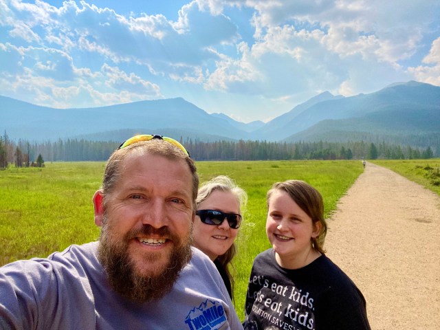
I am a day behind. This post is coming from Lincoln Nebraska on our way home across the plains (BTW kudos to Courtyard Marriott for providing what I consider to be my first “good” Marriott service post COVID-19). Today’s post is mainly about yesterday. In planning our journey home, we decided to spend two nights (a full day) in Fort Collins for a variety of reasons. One: I have been to FoCo and Louise and River has not. Two, River really enjoyed a short tour of CU Boulder and I have good connections to CSU and would be pretty happy if they ended up there.
3 in 3 Aussies agree.. This is the real deal.
Three: Pies and beer. The day dawned smokey but fresh. Louise had work to do in the morning, so I worked on photos and generally catching up with my own work with the decent internet back down on the Colorado foothills. After that we headed to campus for the self-guided tour after a chat in admissions. They had a mockup dorm room which was a clever move by CSU as it allows students to imagine life on campus. We then followed that with an app guided tour. CSU is very impressive, amazing facilities. In Australia we do not get the same level of “fringe benefits” like the rec center at CSU. I know I would very much like access to the climbing wall, gear rental and swimming pool. River did accuse us of enjoying the tour more than themselves a few times (they may have been right). Tour done we headed to a place I was introduced to by my good friend and collaborator, Brenda: The Waltzing Matilda. GREAT pies. I checked with Louise, and we agree this is the most authentic Aussie pie experience we have had outside of Australia (and that is a good thing). What pleased me more was seeing how River wolfed down their pie. You can take the kid out of Australia, but you can’t take the Aussie out of the kid. Next stop, albeit recently commercialized by a corporate takeover, was New Belgian brewing. I love the beer garden set up they have. So communal, beer, dogs, kids, and open space. Very Colorado. Back to the Residence Inn for a last night in Chicago. Catching up on email, writing yesterday’s blog and getting my head back in the game.. And, again, more looking at properties in the Lake County are.. Yes.. I think this thing may happen.
We decided to spend two nights in Fort Collins to give our Child a self-guided tour of the CSU campus. This also mean pack up day at the cabin could also include taking the longer route from above Twin Lakes to our hotel in Loveland. The quickest way to Loveland was the way we came from Boulder, along the major artery that is I70. But how could a trip to Colorado be complete without visiting a National Park? So We discussed our plans Tuesday night and decided to take the long way around. Going via Granby and up via the Trail Ridge Parkway in Rocky Mountain National Park (RMNP). I did not know it at the time but this drive would take us through the absolute gem in the National Park system (and yes I capitalized that on purpose), the trail ridge parkway, or US highway 34 https://en.wikipedia.org/wiki/U.S._Route_34.
Goodbye Twin Lakes!
Before I talk about the amazing part of the trip let me first say the trip from Silverthorne to Granby was really no more than a race across rolling plains like Iowa and Nebraska. Albeit with some amazing geology but the landscape had been raped and pillaged. Not an issue unique to America form my world traveler point of view.
Anyhoo, back to Highway 34. This unassuming tarmac starts as a turnoff near a gas station in a dry valley just before Granby and climbs to reveal a massive reservoir replete with signs thanking fire services (stop burning carbon if you want to thank them, did I say that???). It is clear the residents had much to thank folks, professional and volunteer for. Scorched earth backing up to verdant green surrounding property. Something very Australian about this scene.
Our route.
RMNP started with burned out fee stations and trees burnt and bent by fire forced winds. The underbrush was not spared, and it was clear parts of the park were in for a long recovery.
The valley before the climb.
Turn outs and picnic stations taped off like a crime scene (like? Perhaps as a crime scene). Grassy glades were spared and provided a lush contrast against the black. Made all the more inviting for the death and destruction around. Fortunately, dear reader, things did change. First I will talk about something more pedestrian, the speed limit. In RMNP the speed limit ranged from 35 to 45mph (56 to 72 km per hour for my antipodean (and the rest of the planet) friends). With the overwhelming majority being at the former lower limit. This lower limit protects the wildlife, allows stopping for roadside safari and generally creates an atmosphere that encourages savoring rather that gluttony. As you may perceive I wholeheartedly relished this state-imposed slowdown.
On the climb!
Just after we finished though the sad burnt forest, we did a sharp right had turn with a 20mph warning sign with a number “1” denoting the first of many switchbacks. We climbed, stopping occasionally for wildlife, the views got better and better with glacier scarred valleys and peaks. In the end we had company of fellow travelers including a wonderful group of bikes who allowed locals and immigrants to pose on their bikes for photos, completely heartwarming. We hit the continental divide at Milner pass where we were treated to an alpine tarn full of anglers on floats. We thought, at 10, 759 feet (3279 meters, a full 1051 meters or 3448 feet than the highest point in Australia’s mainland) we were done with climbing… Oh no. The road pushed on to the tree line and above. What followed was the US Government’s attempt to introduce the public to the awe and majesty of nature. Successful I do hope and if not those whose hearts are not touched by this unique landscape are truly lost. Majestic peaks, resilient tundra, ice fields, crepuscular rays.. We hit 12,209 feet. Higher than the 12,095 of the Independence pass. Out highpoint for the journey. I could go in. It’s all there! A John Muir sampler box. I could go on but it is nearly 9pm the day after and I have 500 miles plus to put in tomorrow so I will let the numerous pictures in this post to the talking for the miraculous journey we had yesterday. More to come!
Last full day in the cabin. We will be eternally grateful to our friends for letting us stay here. No, more than that, offering the cabin to us when they heard we were planning a Colorado trip. They have managed to find a slice of heaven up here at the top of this nation. I will not go into details as I wish to respect their privacy but there are some awesome stories about this land dating back to the gold rush.
Disney Princess.
Our last day here dawned ominous. The radar showed heavy rain above the Sawatch range. Of course, radar coverage is pretty terrible here in the Rockies, one reason the Department of Energy is deploying its atmospheric observatory to Crested Butte (I’m an investigator on that!). Anyhoo, I digress. Radar and satellite showed current rainfall moving away from us, but new storms were popping up and we decided to scrub our walking plans and really enjoy the cabin and our friend’s property to the fullest. First task was to clean up our wood pile. We had all been enjoying scavenging fallen dry timber from the 5 acres we had been staying on. While a lot of the wood rots and you should leave this alone a lot of it is suspended on rocks and other trees and is just fuel for a fire, be it intentional or unintentional.
UAV Crew.
Fun around the cabin.
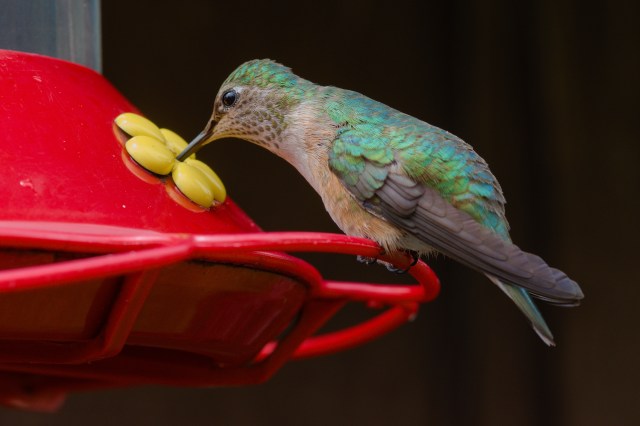
So, clearing clean fallen timber is a good thing. Of course, with 5 acres we barely made a dent! Today was also prime hummingbird watching day. Over the course of our stay, we had learnt more about our tiny, bejeweled friends and they had become more accustomed to us. I wanted to document the different species and, unlike earlier in the week knew they would let me get real close. So I affixed my very well used (20 odd years old) Nikon 105 macro lens to my not so well used Nikon Z7-II camera. The mechanical lenses do not autofocus with the new range of mirrorless Nikon bodies so it was full manual! The Macro lens allows a very close focus which is essential for these cicada sized birds.. Suffice to say I am super happy with the results. Louise got a batch of work from back in Chicago, so I continued to re-stock the cabin with firewood when I noticed a drone overhead. I followed it back prepared to ask the flyers, politely, not to fly over private land. Turns out they were hired by a local utility using LIDAR to look at what corridors needed clearing of fire hazards. Naturally I say, “carry on” and offered help. Louise’s work done the rest of the day was consumed with cleaning and making the cabin cozy for the next, very lucky occupants (and a little more real estate speculation!) Tomorrow. Off to Loveland!